June 23 brought the first day of a two day active pattern over N-NE Italy. A broad 30-35 kt WNW mid-level jet overspread the region while a steady 10-15 kt SW surface wind over the plain produced about 40 kt DLS (and SREH3 in the ~200 m2/s2 range). There was some moderate instability in place across the plain, approximately 1500 J/kg MLCAPE. Good setup for relatively slow-moving supercells.
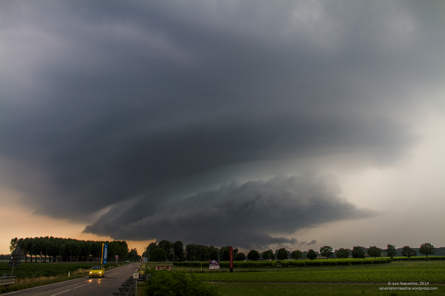
I chased this setup together with Marko Korošec and Andrea Troisi. We first intercepted two relatively short-lived supercells near Gemona at 17h CEST. Both developed some structure, including wall clouds: the first one formed a large wall cloud, but the structure was soon disrupted by hills, the second, smaller one never really developed any great structure. Then around 17:30 CEST a new storm cluster formed on the convergence zone in the extreme E Veneto. It organized slowly and soon split, by 18:20 CEST OSMER Fossalon Doppler radar began showing clear rotation on the southern storm. We moved to intercept from NNE of the storm, coming around the FFD precipitation into good view of the business end of the supercell near Morsano. In the haze an outline of a wall cloud and striated mesocyclone could just be made out. As the supercell approached it displayed some great structure with striated mesocyclone, inflow banding, low hanging rotating wall cloud and inflow tail. All the while huge positive CGs bombarded our surrounding.
Wide field view at 10 mm (DX).
On the move towards SE and the view towards the wall cloud and inflow tail.
And the view into the massive inflow tail and some spectacular structure above.
The wall cloud soon occluded and the storm went outflow dominant. Leaving the dying storm we raced north again to the new, intense supercell that had meanwhile formed on the northern part of the plain and was now near Spilimbergo. However, the unfavourable road network precluded us from reaching it before it entered the hills near Gemona. We did get some good views of the strong updraft and anvil from the distance. The cell reached 70+ dBz reflectivity.
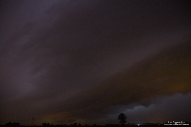
The plain was then quiet for several hours as the prefrontal storms subsided. The main frontal push entered the plain at 22:30 CEST as a huge squall line with embeded supercells descended from the Alps into the NE Italy plains. We first intercepted the line near Vivaro where this shelf cloud structure became visible. There was spectacular stroboscopic CC lightning, but very few CG strikes.
Further south near Morsano (again) we intercepted an embeded mesocyclone with a fairly well developed wall cloud.
The mesocyclone occluded in the next approximately 15 minutes and the squall line raced NE, over us and over the N Adriatic.


